Hurricane Ian - Update 4 - 9/26/2022

.
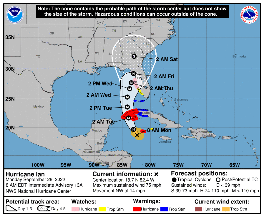
University of Florida officials are actively monitoring Hurricane Ian. While much remains unknown about the storm’s exact path, here is what we know today:
In the 5 a.m., advisory, the National Hurricane Center issued a hurricane watch for Hillsborough, Manatee, Sarasota and Pinellas counties, in addition to a storm surge watch for Pinellas County and the coastal areas of Hillsborough and Manatee counties. Additionally, a tropical storm watch has been issued for the inland portions of Charlotte and Lee counties.
While the storm’s exact trajectory remains uncertain, a hurricane watch means that the National Hurricane Center believes hurricane-force winds are possible in those areas within the next 48 hours. The same 48-hour window applies to areas under a storm surge and tropical storm watch.
UF units should monitor forecasts and be prepared to follow guidance from local officials.
Additionally, Ian strengthened into Category 1 overnight and is expected to become a major hurricane by the middle of this week. The National Hurricane Center considers storms that are Category 3 and above major hurricanes.
Additional storm-related watches may be issued later today, with the northern end of the west coast of Florida and the Florida Panhandle remaining in the storm’s projected path, according to the National Hurricane Center. No operational have been announced for the UF campus in Gainesville as of this message.
We will continue to monitor and update the UF community on expected impacts as information becomes available. Regularly check https://updates.emergency.ufl.edu/ and https://www.ufl.edu/ for updates.
For additional information, please visit National Hurricane Center.
Additional information: Here's how to prepare for hurricane season
